London Satellite Map: Download Free Printable PDF
Have you ever wondered what the London Satellite Map shows about one of the world's most iconic cities? Satellite imagery is a great way to get a fresh look at this sprawling metropolis, whether you're planning a trip, studying urban development, or just curious about London's appearance from above.
Traditional London maps can't match what a detailed satellite view reveals. Google Maps' London satellite feature makes viewing these images easier now. The resolution and customization options users need are often missing though. Finding downloadable, current, high-quality satellite views of London can be tough. This piece will show you how to get a free PDF London satellite map. You'll also discover OnGeo's Satellite Imagery Report service that delivers instant, high-resolution custom maps of specific London properties or areas and beyond.
Download the London Satellite Map – Free Printable PDF Format
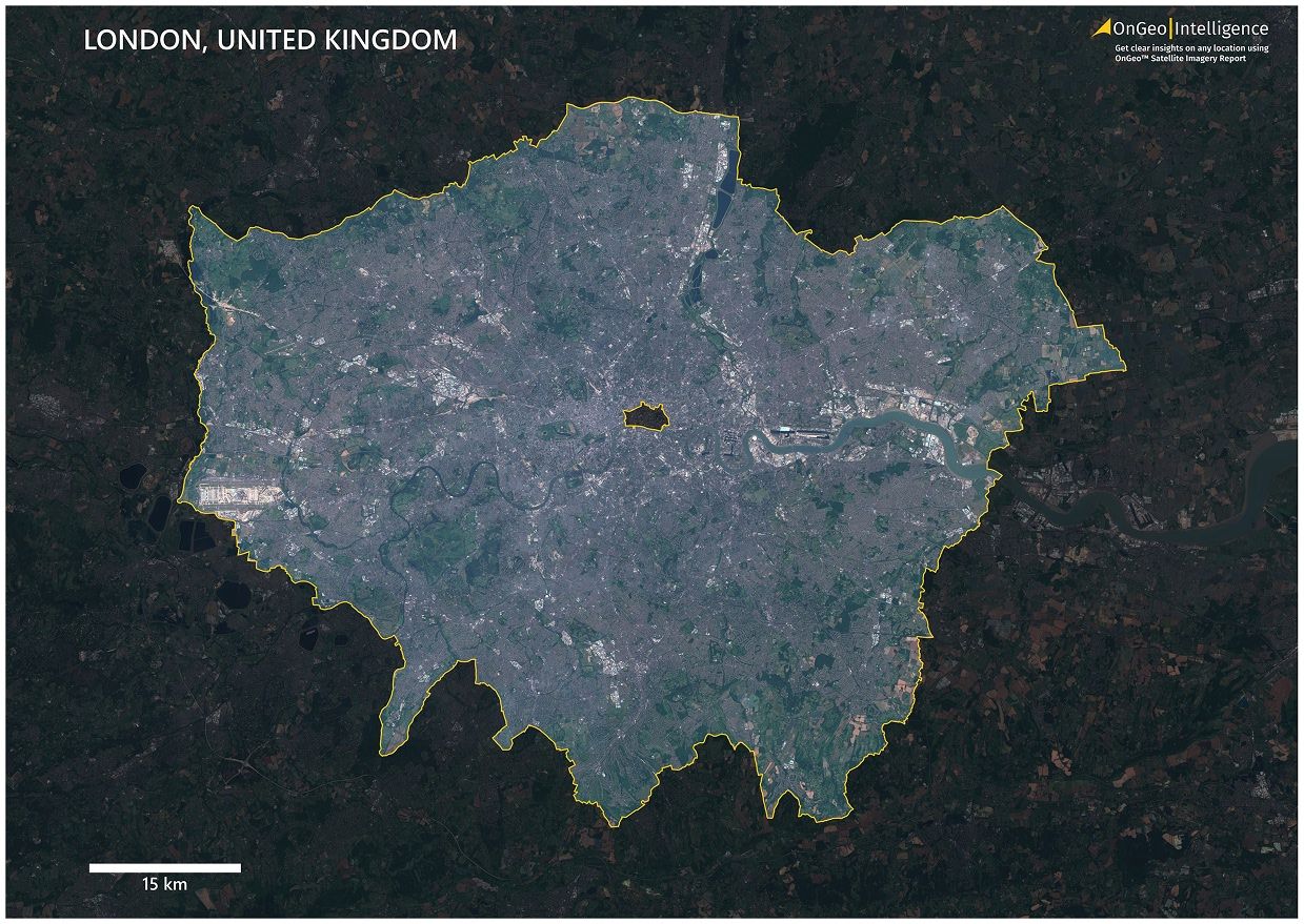
The definitive London Satellite Map is ready for download. Researchers, urban planners, tourists and anyone with an interest in the UK's capital can access this aerial view that shows London's unique urban landscape, green spaces, and the Thames river's path.
📥 [Download Satellite Map of London – PDF, 49.7 MB]
Latest Sentinel-2 satellite imagery from 2024 forms the foundation of this professional-grade map. The specifications are:
- Format: A2 PDF
- File Size: 24.7 MB
- Year: 2024
- Features: Yellow city boundary outline, contrast-enhanced background, scale bar
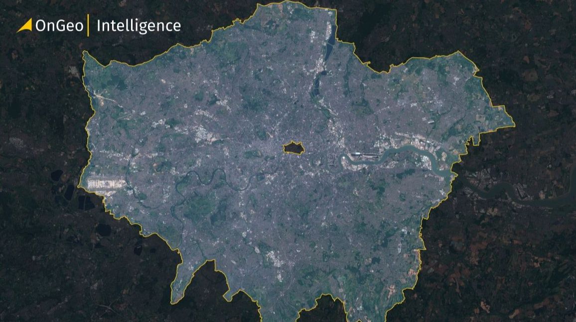
London Satellite Map Thumbnail
This 2024 satellite map delivers remarkable clarity with practical features:
- Natural Color (RGB) Imagery shows London's authentic colors from the urban core to parks
- City Boundary Highlight with yellow outline marks London's official boundaries
- Contrast-Enhanced Background darkens areas outside the city to highlight the main area
- Scale Bar in the bottom-left corner helps measure distances accurately
- A2 Printable Quality suits reports, presentations, or wall displays
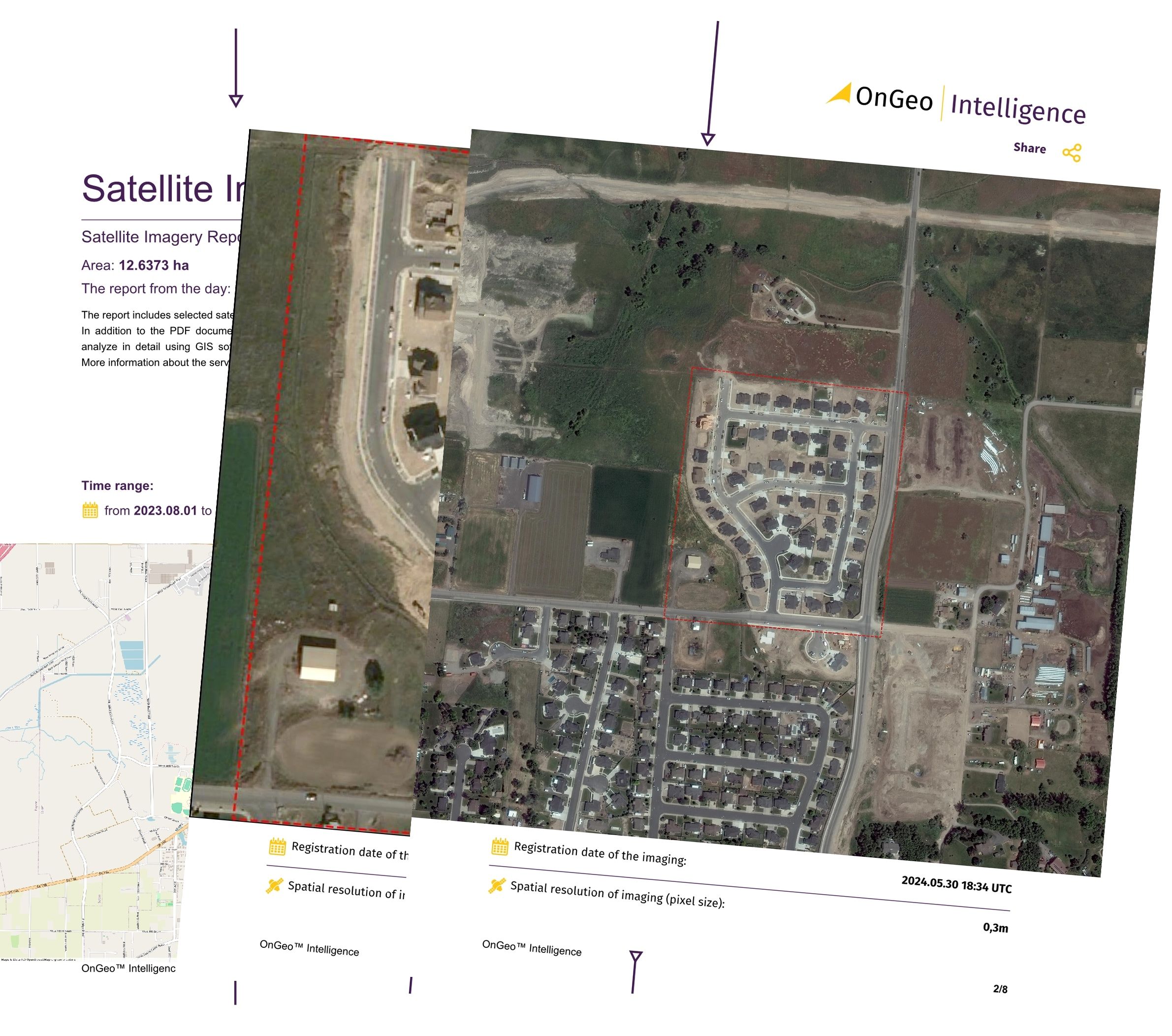
The OnGeo Satellite Imagery Report service creates custom maps for any property
Looking for recent satellite imagery of a specific location or property?
With the OnGeo Satellite Imagery Report, you can instantly generate custom high-resolution satellite maps of any area in just a few clicks — no registration required.
🛰 Key Features:
Access very high-resolution imagery instantly
Delivered in PDF format — perfect for sharing and printing
No login or software needed — works on your phone or PC
Ideal for real estate, agriculture, insurance, environment, and more
What the London Satellite Map Contains
This detailed London satellite map shows an array of urban features in this historic city. The satellite view captures London's complex layout with stunning aerial detail. You'll discover iconic landmarks and hidden gems that regular street maps often miss.
The map shows the Thames River as it winds through London's heart and creates a natural north-south split. The city's famous green spaces stand out beautifully. Hyde Park, Regent's Park, and Hampstead Heath appear as green oases in the dense urban landscape.
The satellite view explains London's diverse urban patterns:
- Central districts with their winding medieval streets
- Planned neighborhoods with grid-like layouts
- Main roads that spread out from the center
- Inner boroughs packed with buildings next to spacious outer areas
- Famous buildings you can spot from above
- Business and industrial zones
- Suburban areas with their typical housing layouts
The dark background makes Greater London's boundaries stand out clearly and shows how the city connects to nearby counties. A yellow outline marks London's official borders precisely. The scale bar helps measure distances accurately, which helps in planning and research.
The natural RGB colors show London exactly as it looks from above. Built-up areas and natural features are easy to tell apart. This real-world view looks much better than stylized maps or black-and-white satellite images.
This map serves as a great resource to understand London's layout, growth, and geography. Researchers, city planners, tourists, and London fans will find it useful. The A2 size shows plenty of detail while being easy to view on devices of all types or print out.
Conclusion
London's view from above shows an array of history, urban growth, and natural beauty that regular maps can't match. This piece explores how satellite images give an exceptional viewpoint of this iconic city. The downloadable London satellite map will give great value to everyone - from tourists to urban researchers.
The high-quality 2024 satellite map shows current, detailed images with useful features like boundary highlights and scale measurements. Its natural RGB colors match London's real appearance. You can easily spot landmarks, parks, and the Thames River. The A3 format gives enough detail that you can use it in many ways.
OnGeo Intelligence's Satellite Imagery Report service offers custom solutions to those who need specific views. This special service has revolutionized how people get property-specific satellite images. Users now receive professional satellite images of any London spot without needing technical know-how. The service is a much faster way to get property images than old methods.
The free London satellite map or custom image service helps you learn about geographic details once known only to experts. You'll see the Thames's curves, big parks, historic areas, and new buildings with amazing clarity from above. So your grasp of London's complex urban world will grow by a lot.
Download the free PDF satellite map today and see London from this amazing height. To name just one example, see how OnGeo's specialized service can give you instant, high-res custom maps that match your needs. Seeing London through satellite images shows this magnificent city's true nature in ways that walking its streets never could.