Free Satellite Imagery Sources: A Complete Comparison
Satellite imagery is no longer a niche resource reserved for governments and large enterprises. Today, it underpins everything from climate intelligence and agriculture to AI-driven analytics and logistics systems.
While commercial providers like Maxar Technologies and Planet Labs offer powerful capabilities, a significant portion of global geospatial innovation is built on free and open satellite data.
Organizations such as NASA and the European Space Agency have made vast amounts of Earth observation data publicly accessible unlocking decades of imagery and enabling anyone with the right tools to analyze the planet at scale.
But “free” does not mean simple.
These datasets vary widely in resolution, revisit frequency, formats, and accessibility. For developers and builders, the real challenge is not finding data it’s understanding which source to use, and how to actually work with it.
This guide breaks down the major free satellite imagery sources, compares their strengths and limitations, and explores how to use them effectively when building modern geospatial applications.
The Major Free Satellite Imagery Sources
The ecosystem of free satellite imagery is built around a few key programs and platforms. Each offers a different balance of resolution, revisit frequency, and accessibility, and understanding these differences is critical when choosing the right data source.
NASA / USGS Landsat Program
The Landsat program is the backbone of free Earth observation data. Running since the 1970s, it provides one of the most valuable historical archives of the planet.
- Resolution: ~30 meters
- Revisit: 16 days
- Strength: Long-term, consistent global coverage
- Limitation: Lower spatial detail
Best suited for:
- Climate change analysis
- Land use and land cover studies
- Historical trend analysis
If your work depends on time depth, Landsat is unmatched.
European Space Agency Sentinel Program
The Sentinel satellites, part of the Copernicus program, represent the modern standard for free imagery.
- Resolution: 10–20 meters (Sentinel-2)
- Revisit: ~5 days
- Strength: Strong balance between resolution and frequency
- Bonus: Radar imaging via Sentinel-1 (works through clouds)
Best suited for:
- Agriculture monitoring
- Disaster response (floods, fires)
- Environmental tracking
- Sentinel is often the default choice for active geospatial projects.
Google Earth Engine
More than just a data source, this is a cloud-native geospatial platform.
- Hosts Landsat, Sentinel, MODIS, and more
- Built-in processing and analysis tools
- Massive global dataset catalog
Strength:
- Eliminates the need to download and manage large datasets
Limitation:
- Requires familiarity with its scripting environment
- For developers, this is often the fastest way to start building.
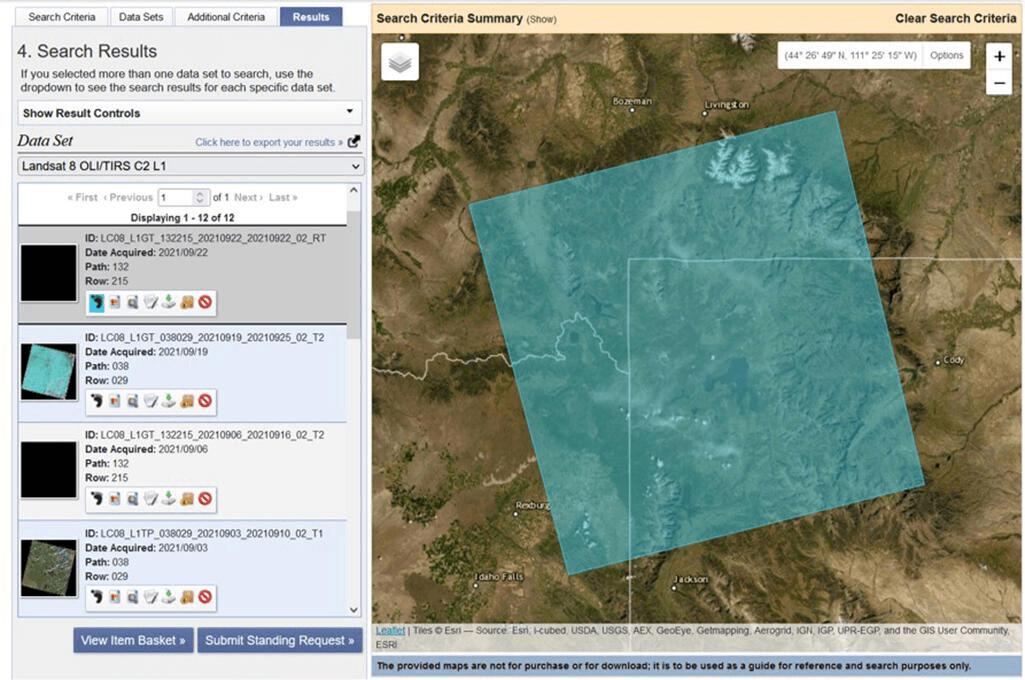
USGS EarthExplorer
A primary portal for accessing Landsat and other datasets.
- Direct downloads of raw imagery
- Wide range of satellite missions
- Strong filtering and search capabilities
Limitation:
- Manual workflow
- Not optimized for automation or APIs
Best for:
- Researchers
- One-off data retrieval
- Archive exploration
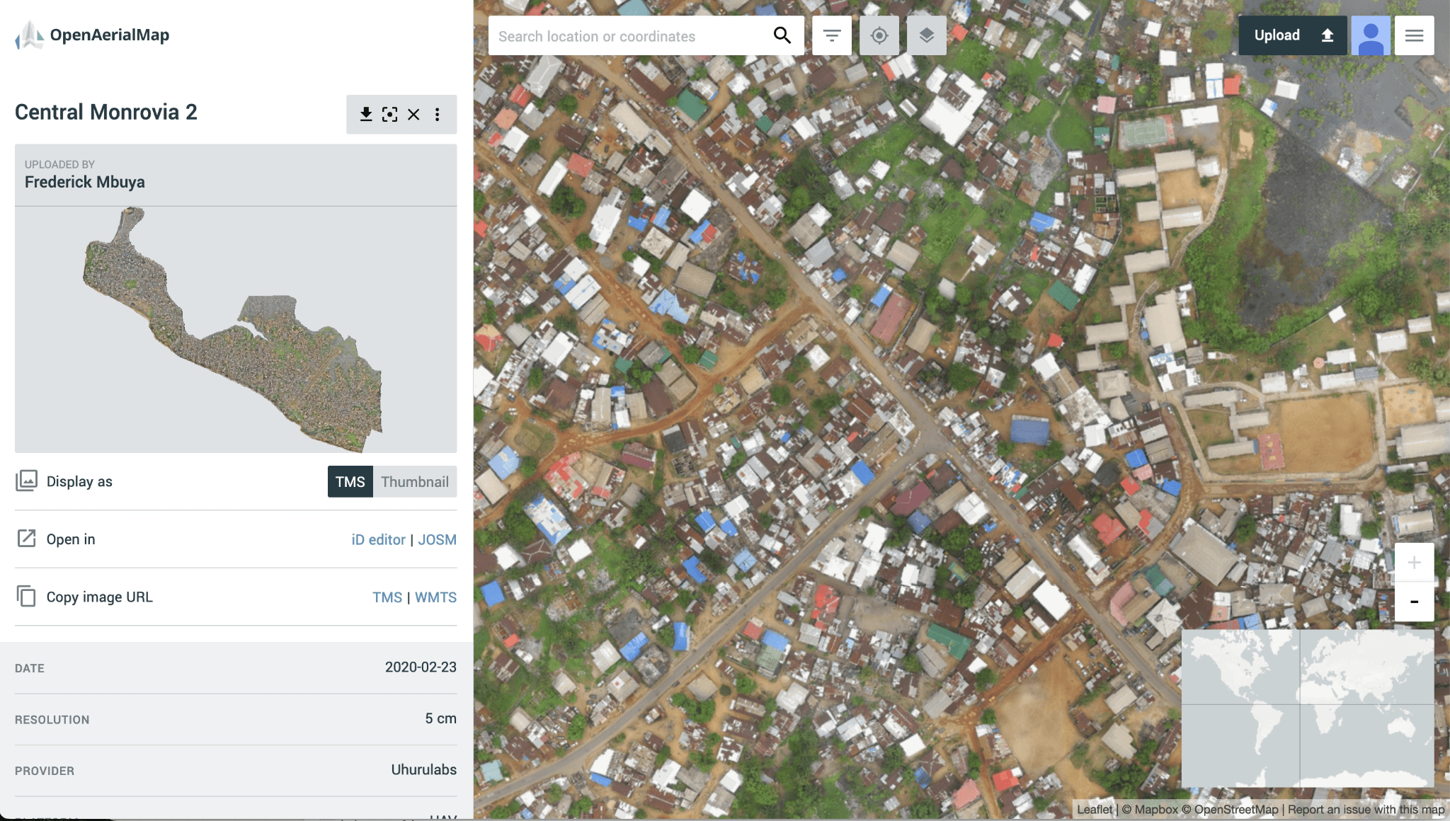
OpenAerialMap
A community-driven platform for openly licensed aerial imagery.
- Resolution: Varies (often higher than satellite imagery)
- Source: Drones, aircraft, and contributions
- Strength: Localized, high-resolution datasets
Best suited for:
- Humanitarian mapping
- Local projects
- Validation datasets
These sources are not interchangeable they are complementary. - Landsat → Historical depth
- Sentinel → Balanced, modern monitoring
- Google Earth Engine → Processing + access
- EarthExplorer → Raw data access
- OpenAerialMap → Local, high-resolution context
Resolution vs Revisit: The Free Data Trade-Off
One of the most important concepts in working with free satellite imagery is the trade-off between spatial resolution and temporal resolution (revisit frequency).
Unlike commercial providers such as Maxar Technologies or Planet Labs, free datasets are not optimized for extreme performance in either dimension. Instead, they strike a balance offering moderate resolution with consistent global coverage.
How OnGeo Intelligence Simplifies the Process
OnGeo Intelligence addresses the complexity of free satellite data by providing:
- Unified access to multiple datasets through a single API.
- Automated preprocessing, including cloud masking and data normalization.
- Ready-to-use insights such as vegetation indices, change detection, and land-cover classification.
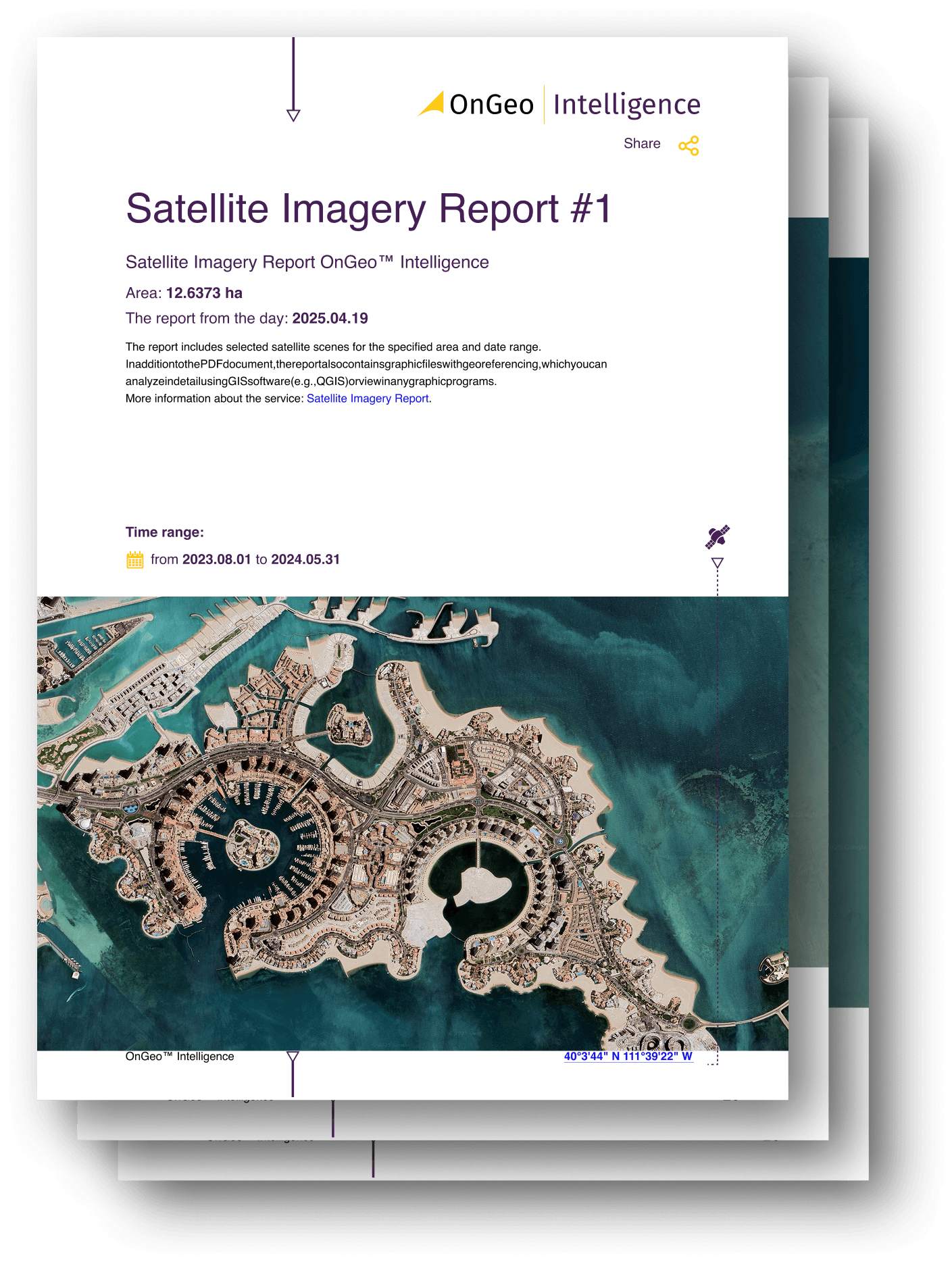
- Free access with code ongeo100 generate reports at no cost featuring 10-meter resolution images
Instead of downloading, cleaning, and processing imagery manually, developers can query data and receive actionable insights directly.
Understanding the Trade-Off
Most free imagery sources fall within a predictable range:
- Resolution: ~10–30 meters
- Revisit Frequency: ~5–16 days
For example:
- European Space Agency’s Sentinel-2 provides higher resolution (~10m) with more frequent revisits (~5 days)
- NASA / USGS’s Landsat offers long-term consistency (~30m) with a slower revisit cycle (~16 days)
This balance is intentional it allows for global, sustainable data collection at scale, without the cost and complexity of ultra-high-resolution imaging.
What You Gain
Even with lower resolution, free datasets are extremely powerful for:
- Pattern detection → vegetation health, water bodies, urban expansion
- Change analysis → deforestation, seasonal shifts, land degradation
- Large-scale monitoring → agriculture, climate systems, environmental risk
In these scenarios, you don’t need to see individual objects you need to understand trends over space and time.
The Real Insight
The trade-off is not a weakness it’s a design constraint that defines how free data should be used.
Free imagery is optimized for scale, not detail.
And for many applications, scale is exactly what matters.
Free Satellite Imagery: Opportunities and Challenges
For developers and startups, free satellite data offers a cost-effective way to build, test, and validate geospatial applications. A practical strategy is to start with free datasets, focus on trends and signals rather than raw imagery, and introduce higher-resolution data only when necessary.
However, the biggest challenge is not access to data but usability. Although organizations such as NASA, USGS, and the European Space Agency provide free imagery, turning raw data into production-ready applications requires overcoming several obstacles:
- Complex formats such as GeoTIFF, NetCDF, and HDF5.
- Massive data volumes that demand significant storage and processing resources.
- Preprocessing needs, including cloud removal, atmospheric correction, and normalization.
- Fragmented access methods across different platforms and APIs.
As a result, the hidden costs of “free” data often come from engineering effort, infrastructure, and maintenance rather than the data itself.
Choosing the Right Data Source
Different datasets serve different purposes:
- Sentinel-2 – ideal for agriculture monitoring and near real-time observations.
- Landsat – best for historical analysis and long-term environmental studies.
- Google Earth Engine – excellent for AI development, experimentation, and rapid prototyping.
- OpenAerialMap – useful for localized, higher-resolution mapping and validation.
A common workflow is to use Sentinel for current monitoring, Landsat for historical context, Earth Engine for development, and local high-resolution data for validation.
Key Takeaway
Free satellite imagery has democratized Earth observation, but raw data alone is often difficult to use at scale. The real challenge is transforming imagery into reliable, actionable intelligence. OnGeo Intelligence simplifies this process by unifying data sources, automating preprocessing, and delivering analysis-ready outputs, enabling developers to build geospatial products faster and more efficiently.
Related articles
- Free Satellite Imagery Providers: Compare and Choose the Best Option
- How Free Satellite Imagery Can Help Farmers Optimize Crop Management
- How to Download Free Sentinel Data: A Step-by-Step Guide
- Generate Satellite Imagery Reports for Free – Limited Time Offer!
- A List of Earth Observation Satellites & Optical Parameters