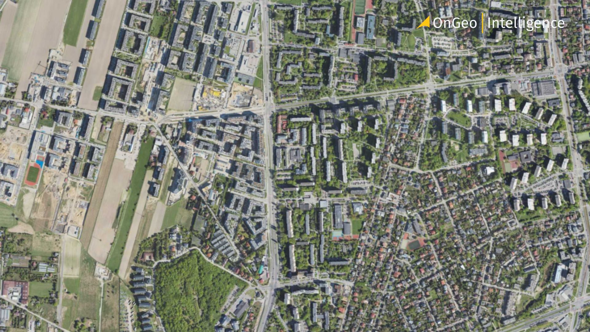
Real Estate Development with Satellite Intelligence
Real estate development relies on accurate insights into land, surroundings, and long-term trends. Traditional methods such as site visits, local records, and market reports remain important but often provide only a limited view of an area’s evolution.
Satellite intelligence offers a broader, data-driven perspective. Using high-resolution imagery and Earth observation data, developers can track historical changes, infrastructure growth, environmental conditions, and future patterns from above.
This article explores how satellite imagery and Earth observation are transforming site selection, zoning analysis, land-use planning, and market trend assessment in modern real estate development.
How Satellite Intelligence Is Used in Real Estate Development
Satellite intelligence supports real estate development by providing consistent, location-based insights that extend beyond what is visible during a single site visit. By analyzing satellite imagery over time, developers gain a deeper understanding of land characteristics, surrounding activity, and long-term trends.
One of the key advantages of satellite data is its ability to deliver area-wide coverage. Instead of evaluating parcels in isolation, developers can assess entire neighborhoods, corridors, or regions, identifying patterns in land use, infrastructure growth, and urban expansion.
Satellite intelligence is commonly used to:
- Assess current land use and surrounding development
- Track historical changes to a site and nearby areas
- Identify environmental constraints such as flood-prone zones or terrain limitations
- Monitor infrastructure development and accessibility
- Compare multiple potential sites using consistent criteria
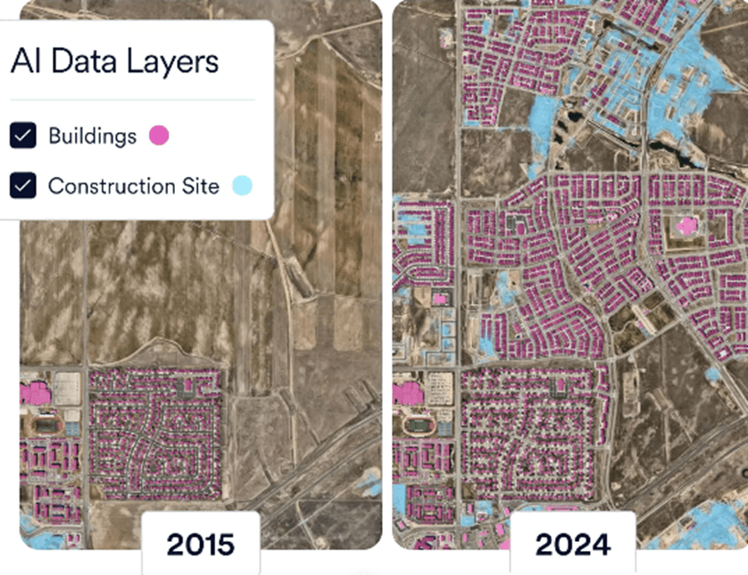
Another important aspect is time-based analysis. Historical satellite imagery reveals how an area has evolved, helping developers understand whether growth is stable, accelerating, or declining. This temporal context reduces uncertainty and supports more informed investment and planning decisions.
Rather than replacing traditional due diligence, satellite intelligence complements it adding objective, visual evidence that strengthens early-stage analysis and reduces risk throughout the development lifecycle.
Zoning, Land Use, and Planning Support
Zoning regulations and land-use plans define how land can be developed, but understanding how these rules align with real-world conditions is often challenging. Satellite intelligence helps bridge this gap by providing visual and spatial context to planning and zoning analysis.
Satellite imagery allows planners and developers to observe how land is actually being used residential, commercial, industrial, agricultural, or undeveloped and how those uses change over time. This is particularly valuable in rapidly growing areas where development may outpace official zoning updates.
In zoning and planning workflows, satellite data is used to:
- Identify existing land-use patterns surrounding a site
- Detect informal or unplanned development
- Monitor compliance with land-use restrictions
- Support planning applications with visual documentation
- Provide evidence for rezoning or variance requests
Historical satellite imagery is especially useful for demonstrating how an area has evolved, offering context for planning decisions and helping authorities evaluate the potential impact of proposed developments.
While satellite data does not replace legal zoning records or planning approvals, it strengthens planning support by adding objective, time-stamped evidence that improves transparency and decision-making.
Market and Urban Growth Analysis
Understanding market dynamics is a critical part of real estate development. Beyond pricing data and demographic statistics, satellite intelligence provides a spatial perspective on how cities and neighborhoods are growing and changing.
By analyzing satellite imagery over time, developers can identify patterns of urban expansion, densification, and infrastructure development. These patterns often signal emerging markets before they are fully reflected in traditional real estate data.
Satellite data supports market and urban growth analysis by enabling developers to:
- Track the spread of residential and commercial development
- Identify new infrastructure such as roads, transit corridors, and utilities
- Observe construction activity and land conversion trends
- Compare growth rates across different areas using consistent metrics
Time-series satellite imagery is particularly valuable for distinguishing between short-term construction activity and long-term urban growth. This helps developers assess whether demand in an area is sustainable or driven by temporary factors.
By combining satellite intelligence with conventional market data, real estate professionals gain a more comprehensive view of market momentum supporting better site selection, timing, and investment decisions.
Risk Assessment and Due Diligence
Risk assessment is a core part of real estate development, particularly in the early stages of land acquisition and project planning. Satellite intelligence supports due diligence by providing objective, historical evidence about a site and its surroundings.
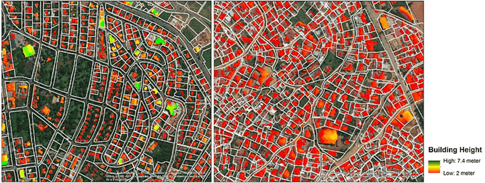
Satellite imagery allows developers to assess environmental and physical risks that may not be immediately apparent during site visits. These include flood exposure, land instability, proximity to industrial activity, and changes in surrounding land use.
Common risk-related use cases include:
- Identifying flood-prone or low-lying areas
- Detecting past land disturbances, excavation, or dumping
- Monitoring encroachment or boundary changes over time
- Assessing environmental constraints that may affect approvals
- Verifying site conditions before acquisition or financing
Historical satellite data is especially valuable for documenting pre-development conditions. This can support legal, insurance, or regulatory processes by providing time-stamped visual records.
By integrating satellite intelligence into due diligence workflows, developers can reduce uncertainty, avoid costly surprises, and make more informed decisions before committing capital.
How OnGeo Intelligence Supports Real Estate Intelligence
Applying satellite intelligence in real estate development often requires access to multiple datasets and technical expertise in geospatial analysis. OnGeo Intelligence helps simplify this process by making satellite-based insights easier to access and interpret.
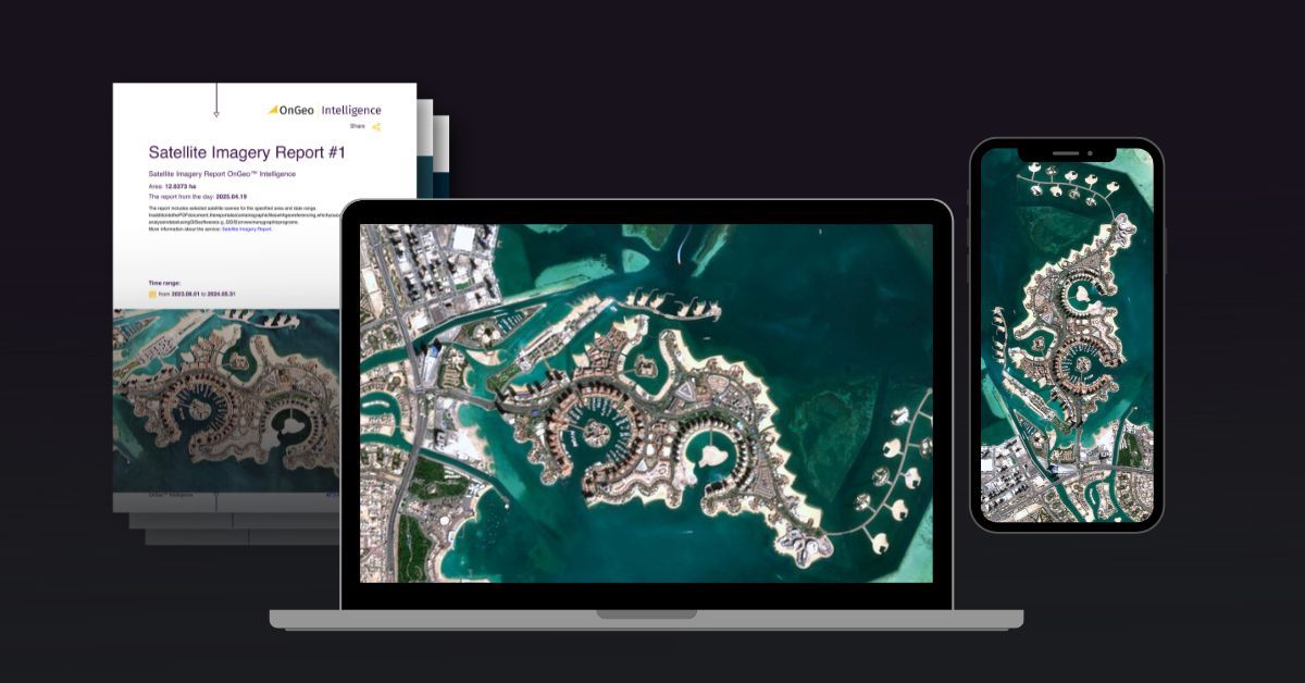
Through OnGeo Intelligence, users can generate location-specific satellite reports that support key real estate workflows, including site evaluation, land-use review, and historical change analysis. Instead of working directly with raw satellite imagery, users receive structured outputs that are easier to review and share with stakeholders.
OnGeo Intelligence supports real estate intelligence by:
- Providing access to up-to-date and historical satellite imagery
- Enabling visual comparison of sites over time
- Supporting early-stage due diligence and feasibility studies
- Delivering clear documentation suitable for reports and presentations
These capabilities are particularly useful for developers, consultants, and analysts who need reliable spatial context without managing complex geospatial tools.
By lowering the barrier to satellite intelligence, OnGeo Intelligence helps real estate teams incorporate Earth observation data into everyday decision-making processes.
Note: OnGeo Intelligence currently offers 10-meter resolution satellite imagery at 100% off for a limited time. Use the code ongeo100 at checkout. Higher-resolution satellite images remain subject to standard pricing.
Practical Steps: Applying Satellite Intelligence in Real Estate Development
Define the Objective and Area of Interest
Start by clarifying the goal of your analysis whether it’s site acquisition, rezoning, market evaluation, or risk assessment. Then define the target parcel and its surrounding context to get the most relevant insights.
Analyze Current and Historical Imagery
Review recent satellite images to assess present land use, infrastructure access, nearby developments, and physical constraints. Then compare them with historical images to understand how the area has evolved over time, including urban expansion, land use changes, or recurring issues like flooding.
Identify Risks, Opportunities, and Market Signals
Use satellite data to detect environmental risks such as flood zones or land instability, while also spotting growth indicators like new construction, infrastructure development, and urban densification.
Document Findings and Integrate with Traditional Due Diligence
Compile the key insights into clear visual reports suitable for stakeholders or submissions. Always combine satellite intelligence with on-site visits, legal zoning checks, and market data for a complete and reliable assessment.
What to Look Out For
Satellite intelligence is a powerful tool for real estate development, but it has important limitations.
It often lacks fine detail, missing small structures, interiors, or underground utilities, so it cannot replace on-site inspections. Images are not real-time, therefore always check the acquisition date. Visible changes like cleared land do not guarantee legal approval they must be verified with zoning records and permits. Environmental conditions can also be misleading due to seasonal or weather-related changes.
For best results, use satellite data as a complementary tool alongside site visits, legal reviews, and local expertise.
Why This Matters for Modern Real Estate Development
Real estate development faces rapid urban growth, environmental constraints, and rising financial risks. In this environment, timely and objective data is essential.
Satellite intelligence goes beyond static snapshots by showing how sites and surroundings evolve over time. It enables better site selection, more accurate risk assessment, and smarter planning decisions especially in fast-growing or data-scarce markets.
As competition for land intensifies and regulations tighten, the ability to analyze locations at scale becomes a key competitive advantage. Satellite data helps developers evaluate multiple sites efficiently, reduce early-stage uncertainty, and improve transparency with investors and authorities.
Real Estate Development with Satellite Intelligence Final Thoughts
Satellite intelligence is becoming a valuable asset in real estate development. It provides clear insights into land conditions, urban growth patterns, and historical changes, strengthening early analysis and reducing risk throughout the project lifecycle.
When combined with traditional research, satellite imagery adds objective spatial context that leads to better decisions, faster evaluations, and more effective risk management.
Tools like OnGeo make this technology accessible, turning Earth observation data into practical insights that support smarter, more sustainable development workflows.
Related articles
- Detection of Illegal Construction in Satellite Images
- Real-Time Satellite Imagery
- Legalisation of unauthorised buildings using satellite images
- Satellite Maps: Viewing Your Neighborhood and Beyond
- High Resolution Satellite Imagery: Best Quality Sources
- Construction Site Monitoring with Satellite Images
- How to Obtain Satellite Imagery of Your Plot? OnGeo Intelligence Guide